Teiki Mathieu Baillan surfing a self-made Alaya surfboard in Macaroni, Mentawaï, Indonesia. Photo by C. Naslain, 2009.
Enjoy and contribute!
| Find the best surf spots |
|
|
 Brunei
Asia
Location: Southeastern Asia, bordering the South China Sea and Malaysia
Geographic coordinates: 4° 30' N, 114° 40' E
Coastline km: 161 km km
Climate: tropical; hot, humid, rainy
Terrain: flat coastal plain rises to mountains in east; hilly lowland in west
Elevation: lowest point: South China Sea 0 m
highest point: Bukit Pagon 1,850 m
Natural hazards: typhoons, earthquakes, and severe flooding are rare
Currency: Bruneian dollars (BND)
Population: 388,190 (July 2009 est.)
Languages: Malay (official), English, Chinese
Capital: Bandar Seri Begawan
Divisions: 4 districts (daerah-daerah, singular - daerah); Belait, Brunei and Muara, Temburong, Tutong
More details
| Jan/Feb | Mar/Apr | May/Jun | Jul/Aug | Sep/Oct | Nov/Dec | |
|---|---|---|---|---|---|---|
| Best Surfing Season | ||||||
| Typical Swell Size | ||||||
| Surf Equipment | ||||||
| Water temp. | ||||||
| Air temp. | ||||||
| Climate | ||||||
Seasonal swell & wind variations
Wanna add some info about Brunei? Let us know...
This is an interactive map! Use controls to pan and zoom this map.
- Favourite
-
Your favourites and future surf spot lists
Surf Spots
| Surf Spots (3) | Quality | Direction | Type | Frequ | Experience | ||
|---|---|---|---|---|---|---|---|
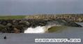
| Berakas Coastal Park | 1 / - | Right and left | Sand-bar | 
|
All surfers | ||
| Pantai Tungku | 12 / - | Right and left | Beach-break |
|
All surfers | ||
| Tanjung Batu | 1 / - | Don't know | Rivermouth |
|
All surfers |
 Comments
Errors, Feedback
If you want to add new information or you have found errors on this country, Send us feedback.
Advertise
On the Go!
Wannasurf.com on your mobile
![]()
RSS All the RSS feeds of Wannasurf.com
Newsletter All news by email